Oxfordshire Landscapes.
1 Physical landscapes and Oxfordshire Geology Trust
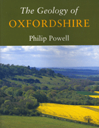
GEOLOGY OF OXFORDSHIRE Philip Powell. Dovecote Press. Wimbourne 2005
New reprint of this book is now available
The author states, “The object of this book is to explain something of how the rocks (of Oxfordshire) were formed and their arrangement.” This is achieved within a well-illustrated account of such interest and clarity that the receptive audience will range from the established geologist to those who have an intelligent, but non-specialist knowledge of the landscape of the county and how it was formed. The author is careful to conclude by bringing the story up to date by including Quaternary landscape changes, acknowledging that, “It should be kept in mind that Oxfordshire as we know it today has been shaped only in the last few thousand years.” A well rounded book which will find a place on the shelves of those who have a fascination in the subtle interplay between geology and landscape in this gentle county.
Oxfordshire Geology Trust
This not-for-profit organisation has a large programme of events encouraging the public, including children, to enjoy and conserve Oxfordshire’s earth heritage. Below is a range of their landscape trails (secrets in the landscape). To learn more about the Oxfordshire Geology Trust visit www.oxfordshiregt.org
01 FARINGDON TRAIL, secrets in the landscape (Oxfordshire Geology Trust)
12 page folding booklet 11X24cm, 14 colour plates, 6 maps and figures. £2
Starting in the town centre the walk circumnavigates the town including such sites as the Bell Hotel, All saints Church, Folly Hill, with views out over the Oxford Clay Vale, Folly Park, Coxwell Pit and the Highworth Road. Attention is drawn to the way the town is intimately connected with the limestone ridge upon which it is built.
02 KIRTLINGTON AND BLETCHINGDON TRAIL, secrets in the landscape
12 page folding booklet 11X24cm, 9 colour plates, 13 maps and figures. £2
The trail starts in Kirtlington Quarry rich in limestone fossil shells and Ooids. The walk continues to the limestone-built Pigeon Lock with views of Pound Hill, isolated within an abandoned meander. In Bletchingdon, the houses, walls and roofing material all emphasis the presence of limestone beneath.
OUT OF STOCK
03 OXFORD CITY TRAIL, secrets in the landscape(Oxfordshire Geology Trust)
12 page folding pocket booklet 11X24cm, in full colour. 16 plates, 5 maps and figures. £2.00
This introduction to the geology of the city of Oxford including Headington (Quarries and stone walls) and the city centre (Magdalen College, the High Street and St Michael’s Tower). Building materials include local limestone from Headington but stone was also brought in from quarries in the Cotswolds, including from Burford and Chipping Norton.
04 STONESFIELD TRAIL, secrets in the landscape (Oxford Geology Trust)
12 page folding pocket booklet 11X24cm, in full colour. 17 plates, 7 maps and figures. £2
A two-hour circular walk through an area famous for its stone slates and for its early discovery of fossil dinosaurs. No dinosaur fossils guaranteed but there is the opportunity to examine fossil-rich limestone in walls and houses. There is evidence too for climatic change both in the rocks and their fossils and evidence of more recent change since the last ice age.
05 ADDERBURY TRAIL, secrets in the landscape (Oxford Geology Trust)
12 page folding pocket booklet 11X24cm, in full colour. 16 plates, 5 maps and figures.£2.
Adderbury stands on Marlstone, an ironstone which gives its building stones a rich red colour but a stone which is vulnerable to weathering, something which you will quickly notice as you tour the village. The village is surrounded by rich, attractive rolling farmland which again has a close relationship to the rocks beneath.

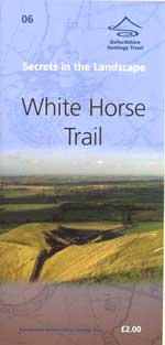
06 WHITE HORSE TRAIL, secrets in the Landscape (Oxford Geology Group)
12 page folding pocket booklet 11X24cm, in full colour. 22 plates, 5 maps and figures.£2
From the Uffington White Horse carved into the 261 metre high White Horse Hill, explore the 2800 year old earthworks of Uffington Castle with its outlier of Dragon Hill. To the south of the crest of the escarpment runs the 85 mile long Ridgeway, probably the oldest ‘road’ in Britain. From here there are unparalleled views out across the clay Vale of the White Horse. The trail explores the chalk upland landscape as well as offering explanation for the presence of ‘sarsens’, flints and chalk as a building stone.
OUT OF STOCK
07 BURFORD TRAIL, secrets in the Landscape (Oxfordshire Geology Trust)
12 page folding pocket booklet 11X24cm, in full colour. 12 plates, 9 maps and figures. £2
The High Street descends steeply from the Jurassic Limestone ridge towards the bridge across the River Windrush. The honey-coloured limestone has provided the building stone for many of the buildings in the town. Taynton Stone was used to build the large church, sometimes called the ‘cathedral of the Cotswolds’. From five quarries around Burford, Taynton Stone was often sent down the Thames to places like Oxford and London where it was used in St Paul’s Cathedral. The trail also discusses the form of the River Windrush, its water mills and its dry valleys as well as drawing attention to the many layers of different rocks which make up the Cotswolds.
08 CHIPPING NORTON TRAIL, secrets in the landscape. (Oxfordshire Geology Trust)
12 page folding pocket booklet 11X24cm, in full colour. 15 plates, 9 maps and figures. £2
Chipping Norton is built on a plateau of limestone, about 200 metres above sea level. A small but deep steep-sided valley cut into this limestone plateau makes this a good place to explain how the Cotswold landscape is dictated by its geology. In part this might also explain why perhaps the most famous geologist in the world (William Smith 1769 - 1839) was born here. In such an environment it is not surprising that the trail has sections on Cotswold building stones, Jurassic fossils, Oxfordshire Ironstone, geological sections, springs and even on William Smith himself.
2 History and Landscapes
THE SEVEN SHIRES WAY Elaine Steane 2002.
ISBN 978-1-873877-51-7 Readon Publishing. RRP £12.95 Our price £8.00
At the Thematic Trails specially negotiated price of £8 it is undoubtedly our bargain of the year and is available at this price only by direct purchase from Thematic Trails, or Longworth and District History Society. 200 pages. 113 OS map extracts. 78 illustrations.
The book covers 21 independent walks, each existing in its own right and each of which can be achieved easily in one day. Instructions include suggested public transport for good access to each of the walks which are exclusively on public rights of way. Directions include many relevant excerpts from Ordnance Survey maps covering all the walks.
The walks are arranged in linear sequence so that, if you have a mind to do so, in 21 days or less you can circumnavigate the county of Oxfordshire, straying into seven shires on a walk which, in total, covers 234 miles. A useful list of overnight accommodation is included for those undertaking all or part of this longer option.
The walks include a wide variety of scenery from the marlstone scarp slope of Edgehill, the ironstone villages of North Oxfordshire, the clay vale of Aylesbury, the beech woods of the Chiltern Hills, the riverbanks of the Thames, the open downland of Berkshire and the Cotswold villages in Gloucestershire. With clear illustrations this ‘walking companion’ included commentary on archaeology, history, botany and some of the many literary connections.
RURAL LIFE IN THE VALE OF WHITE HORSE 1780-1914 Nigel Hammond
ISBN 978-0-9522467-0-1 Rectory Orchard Books 1993. 166 pages. 73 illust. RRP £7.95 Thematic Trail Price: £6.
This book deals with the social, economic, political, agricultural and industrial activity of the four towns: Abingdon, Faringdon, Wallingford and Wantage, and the numerous rural settlements scattered between them. Subjects include enclosure, farming techniques, the Berkshire Pig, weights and measures, markets and fairs, village fetes, the canals, the Great Western Railway, turnpikes, the Wantage Tramway and fox hunting.
GINGE TO LOCKINGE, HISTORICAL WALK John Brooks
ISBN 978-0-948444-10-4 Thematic Trails 1988. £2.95
36 pages. 24 illustrations. Whilst walking through a village landscape in West Oxfordshire, historical sources and the landscape itself are combined to demonstrate how evidence from a variety of sources can be used to throw light on the nature and rate of historical change which has taken place in this small area of English countryside.
THE ABINGDON WATERTURNPIKE MURDER, a True-life Tale of Crime & Punishment. Mark Davies.
ISBN 978-0-9535593-2-9. Oxford Towpath Press 2003. 132 pages. £6.99.
“This is a true story. All the main characters in it actually lived in or near Abingdon at the end of the eighteenth century; most – ordinary working people of little note – would no doubt be greatly surprised to find themselves remembered over 200 years later. But that, I hope is part of the charm of this tale. Dramatic in its own right – what murder isn’t, after all? ...” Mark Davies.
Essentially the story is woven from 25 documents held at the Oxfordshire Record Office in Oxford. A fascinating insight into 18th century life of the labouring poor with a murder thrown in.
