Gloucestershire and the Cotswolds.
The first book investigates the building stones used in Gloucester. The other booklets from the Gloucestershire Geology Trust are Geology and Landscape trails for a series important sites within Gloucestershire
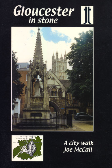
GLOUCESTER IN STONE Joe McCall ISBN 978-0-948444-37-1 Thematic Trails 1999. £1.00
A5. 40 pages. 28 photos. 11 figures. Four compass-point streets radiate from Gloucester city centre. The first short walk, Eastgate Street, is, in essence a mental tool-kit for identifying some local common building stones and their history – a skill which can then be applied to any of the three following compass direction walks.
GEOLOGY OF OXFORDSHIRE Philip Powell. Dovecote Press. Wimbourne 2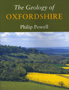 005
005
ISBN 978-1-904349-19-8 pp. 103 coloured plates, 27 maps, 5 tables. £10.00
The author states, “The object of this book is to explain something of how the rocks (of Oxfordshire) were formed and their arrangement.” This is achieved within a well-illustrated account of such interest and clarity that the receptive audience will range from the established geologist to those who have an intelligent, but non-specialist knowledge of the landscape of the county and how it was formed. The author is careful to conclude by bringing the story up to date by including Quaternary landscape changes, acknowledging that, “It should be kept in mind that Oxfordshire as we know it today has been shaped only in the last few thousand years.” A well rounded book which will find a place on the shelves of those who have a fascination in the subtle interplay between geology and landscape in this gentle county.
Gloucestershire Uncovered Trail Guides
A series of trail guides exploring the Geology, landscape and natural heritage of Gloucestershire.
SOUDLEY VALLEY RURAL GEOLOGY TRAIL (Forest of Dean) Gloucestershire Geology Trust
ISBN 978-1-904530-00-8 12pp, 11x24cm, 6 colour plates, 5 maps and figures £1.95
The Soudley Valley, near Cinderford, exposes nearly 100 million years of Earth's history in the rocks exposed in quarries and cuttings on either side of the valley. Rocks range from Devonian sandstones, mudstones and conglomerates, to Carboniferous coal seams, containing well preserved plant fossils.
OUT OF STOCK
CLEEVE HILL RURAL GEOLOGY TRAIL (Cotswolds) Gloucestershire Geology Trust
ISBN 978-1-904530-01-5 12 pp, 11x24cm, 17 colour plates, 5 maps and figures £1.95
Cleeve Hill is the highest point of the Cotswolds, with views across the Severn Vale to the Malverns, and west across the rolling Cotswold Hills. The numerous old quarries on Cleeve Hill provide the most complete sequence of Middle Jurassic Inferior Oolite rocks in the country, including some not seen anywhere else.
OUT OF STOCK
LECKHAMPTON HILL RURAL GEOLOGY TRAIL (Cotswolds) Gloucestershire Geology Trust
ISBN 978-1-904530-05-3 12pp, 11x24cm, 13 colour plates, 5 maps and figures £1.95
Leckhampton Hill is a country park owned and managed by Cheltenham Borough Council and provides the thickest sequence of Middle Jurassic Inferior Oolite rocks along the Cotswold Escarpment. The guide includes information on the industrial heritage and history of the hill, which has been the site of extensive quarrying and civil unrest in the past.
ROBINSWOOD HILL RURAL GEOLOGY TRAIL Gloucestershire Geology Trust
ISBN 978-1-904530-02-2 12pp, 11x24cm, 4 colour plates, 7 maps and figures £1.95
Robinswood Hill is an outlier of the Cotswolds, now a country park, owned and managed by Gloucester City Council. The main quarry on the hill provides the best inland section of Early Jurassic clay and siltstones and was once used to supply raw material for Gloucester brickworks. The many springs that emanate from the hill supplied the first running water to the city of Gloucester.
CRICKLEY HILL GEOLOGY AND LANDSCAPE TRAIL Gloucestershire Geology Trust
ISBN 978-1-904530-06-0 12pp, 11x24cm, 14 colour plates, 5 maps and figures £1.95
Crickley Hill is an important area for geology, biodiversity and archaeology. The cliffs of Crickley Hill provide the thickest section through the ‘Pea Grit’ in the Cotswolds, beech woods and limestone grassland provide a diverse range of habitats for wildlife and there are the remains of hillforts dating back to the Neolithic, Bronze and Iron Ages.
STONEY FURLONG AND CHEDWORTH VALLEY GEOLOGY AND LANDSCAPE TRAIL Gloucestershire Geology Trust 2007
ISBN 978-1-904530-10-7 pp 12, 11x24cm, 18 colour plates, 6 maps and figures £2.00
The old quarry and railway cutting known as Stony Furlong exposes part of the White Limestone (Great Oolite Group), and Chedworth Valley is one of many deeply incised valleys of the Cotswolds, fed by springs emanating from the limestones in the valley sides. The trail explores the uses of local stone, from building and roofing, to aggregate and walling.
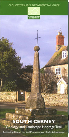 SOUTH CERNEY GEOLOGY AND LANDSCAPE HERITAGE TRAIL Gloucestershire Geology Trust 2008
ISBN 978-1-904530-17-6 pp 10, 11x24cm, 18 colour plates, 5 maps and figures £2.00
The pretty village of South Cerney has a wealth of recorded history going back to the Bronze Age, yet it is the geology on which the village stands that has determined its character. This guide leads a walk around the village to see how the rocks have shaped its landscape and development.It can be linked to a second trail of similar length in nearby Keynes Country Park.
KEYNES COUNTRY PARK GEOLOGY AND LANDSCAPE HERITAGE TRAIL Gloucestershire Geology Trust 2008
ISBN 978-1-904530-16-9 pp 10, 11x24cm, 18 colour plates, 6 maps and figures £2.00
The Cotswold Water Park is one of the most rapidly changing landscapes in Britain today. Sand and gravel extraction leaves large pits that are allowed to flood to create lakes, used for leisure and as wildlife havens. The gravels were deposited here by a major river system during the Ice Ages when man started to settle the area. Removal of soil and gravel has not only yielded a treasure trove of archaeological remains, but also revealed a fascinating natural history story stretching back 165 million years.
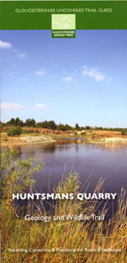
HUNTSMANS QUARRY AND WILDLIFE TRAIL Gloucestershire Geology Trust 2008
ISBN 978-1-904530-19-0 pp 8, 11x24cm, 7 colour plates, 4 maps and figures £2.00
This trail is located just north of the village of Naunton, in the heart of the Cotswolds. You will see a disused quarry face, now a Site of Special Scientific Interest (SSSI), footprints from the 150 million year old dinosaur 'Megalosaurus', and learn about the flora and fauna inhabiting the area today. You will find out what the stone here is used for, and how the land is restored once quarrying has finished.
FOSS CROSS QUARRY GEOLOGY GUIDE Gloucestershire Geology Trust 2008
ISBN 978-1-904530-18-3 pp 12, 11x24cm, 24 colour plates, 8 maps and figures £2.00
The quarry at Foss Cross was active during the first part of the twentieth century extracting White Limestone for use as an aggregate in construction work and as ballast on the old Cheltenham to Southampton railway line. The White Limestone Formation is part of the Great Oolite Group, dating from c. 165 million years ago, and different beds in the quarry face demonstrate different features and a range of fossils.
COATES AND THE THAMES & SEVERN CANAL / THE SOURCE OF THE THAMES GEOLOGY AND LANDSCAPE HERITAGE TRAIL Gloucestershire Geology Trust 2008
ISBN 978-1-904530-15-2 pp 12, 11x24cm, 21 colour plates, 8 maps and figures £2.00
This guide explores the area around the village of Coates looking at landscape and heritage features and their relationship to the geology of the area. Either a 3km or 5.5km trail can be followed, with the option of diverting to look at the source of the River Thames. During your walk, you will see rocks dating back c. 165 million years and will learn how the composition, location and fracturing of these rocks has given us building stone and springs, dry valleys and a major river, engineering difficulties and one of the most important aquifers in the UK.
OUT OF STOCK
CHEDWORTH RAILWAY CUTTING GEOLOGY TRAIL Gloucestershire Geology Trust 2008
ISBN 978-1-904530-20-6 pp 12, 11x24cm, 22 colour plates, 6 maps and figures £2.00
The railway cutting running behind the Roman Villa at Chedworth exposes a faulted section through the upper part of the Inferior Oolite Group. The rocks contain numerous fossils and the railway line is now a wildlife reserve, owned and managed by Gloucestershire Wildlife Trust. Active rock forming can be seen in the cutting where a spring is depositing tufa over the side of the cutting.
OUT OF STOCK